Experience the Dan River, part of the Southern Virginia Wild Blueway, where three rivers and two lakes span Halifax and Mecklenburg counties. This unparalleled paddling destination offers untouched landscapes, abundant wildlife, and easy access from major metro areas. Whether you seek a leisurely lake excursion or a challenging multi-day river adventure, the Blueway and delivers.
In this series, written and reviewed by paddling enthusiasts, we’ll look at a different part of the Blueway with each post. Posts will break down the river and lakes into sections based on publicly accessible boat ramps, along with a description of the area, milage, time estimates, and wildlife you may encounter. The third and last section to be reviewed in this series is The Dan River.
The Dan River
The Dan River displays the variety of landscapes that can be found within the state and county. From its humble beginnings as a mountain stream on the Eastern Slopes of the Blue Ridge Mountains to its formation of the Kerr Reservoir, the Dan River encapsulates the wide variety of species and fishing opportunities that can be experienced in Virginia. As far as Halifax County is concerned, the river crosses the state border next to Virginia International Raceway, then flows through fields and farmland, passing Downtown South Boston, ending on a stretch of forests and wetlands as it feeds Buggs Island Lake.
This waterway not only showcases nature’s splendor but also plays an important role in history. As it traverses Halifax County, the historic homes and properties of River Road lay just out of view. Closer to South Boston are Irvin and Boyd ferries, which played pivotal parts in the Revolutionary War. Using these ferries, Nathaniel Greene’s men crossed the river, allowing them to escape the pursuit of General Cornwallis. Once across the river, Greene’s men held the ferries, preventing British troops from crossing the river.
1. Milton to Paces
This segment of the river begins in Milton, North Carolina, then almost immediately crosses the Virginia border into Halifax County. Shortly after passing under the Route 62 bridge, paddlers may notice a creek on the right side of the river. Country Line Creek’s name dates back to colonial times, when it divided the countries of Virginia and North Carolina. Shortly after, one may hear the roar of engines, as the Dan passes Virginia International Raceway. Around halfway to Paces, the river passes beneath Highway 58 before meandering through fields and farmland until reaching Paces.
Note: The launch point where Highway 58 crosses the Dan River (Leggett’s Bottom) was damaged due to excessive flooding. Additionally, the old boat ramp in Paces is located on private property. Paddlers should instead remove their boat on the bank river left. There is no dedicated parking at this location.
- Put In: Milton Boat Ramp (Route 62)
- Take Out: Melon Road Bridge
- Distance: 14 miles
- Estimated Time: 5 – 7 hours
2. Paces to Greene’s Crossing Landing
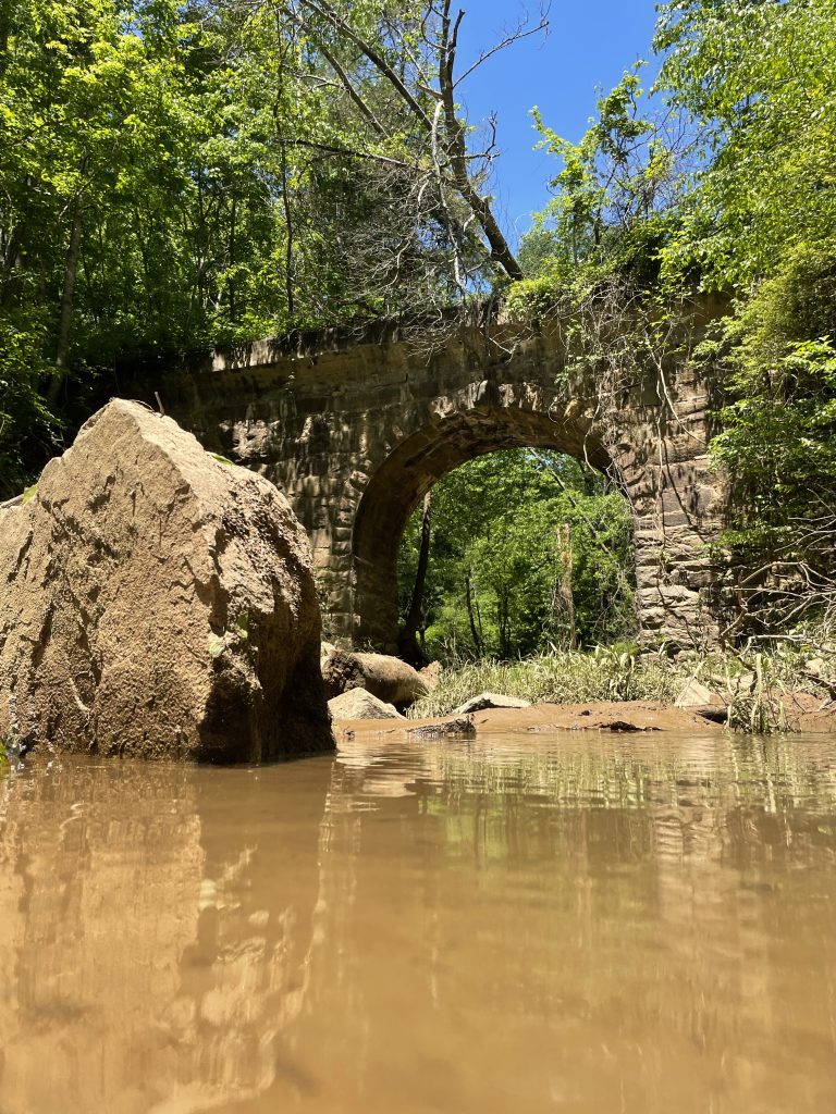
While continuing through fields and farmland, this section of the Dan River is steeped in history. Early in this float, you may notice an old stone bridge crossing one of the creeks that feeds the Dan. Downriver is Roger’s Island, at one point proposed to be a nudist colony. Shortly after Roger’s Island is the site of Irvin’s Ferry, where some of Nathaniel Greene’s men crossed the Dan River while evading British forces. Just past this is the back side of the Berry Hill property, where you may catch a glimpse of the stone wall lining the property or the Tobacco Heritage Trail. Near the end of this segment is Boyd’s Ferry, another location Greene’s men crossed when outrunning Cornwallis’s men. Greene’s Crossing Landing is next to the bridge on river right.
- Put In: Melon Road Bridge (Route 658)
- Take Out: Greene’s Crossing Landing
- Distance: 14 miles
- Estimated Time: 5 – 6 hours
3. Greene’s Crossing Landing to Maple St Boat Ramp
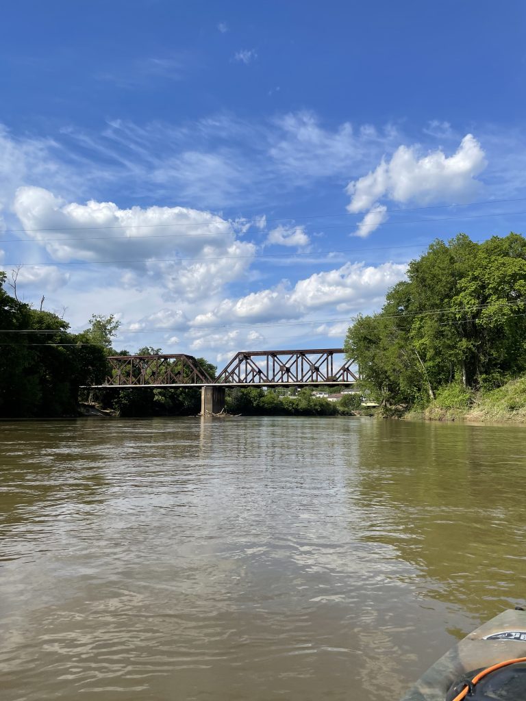
This short segment, between both boat ramps in South Boston, is ideal for anglers and people who want a short venture on the water. As a halfway point between Paces and Staunton River State Park, a jon boat can explore up or down river in search of the perfect fishing hole away from the easily accessible riverbanks near downtown South Boston. Paddlers can drop anchor and fish along the way. Shortly after passing the 360 bridge, the Maple Street Boat Ramp will be river left.
This segment can be added to the section that precedes or follows it, adding roughly one mile to either trip.
- Put In: Greene’s Crossing Landing
- Take Out: Maple Street Boat Ramp
- Distance: 1 mile
- Estimated Time: 30 minutes
4. Maple St Boat Ramp to Staunton River State Park
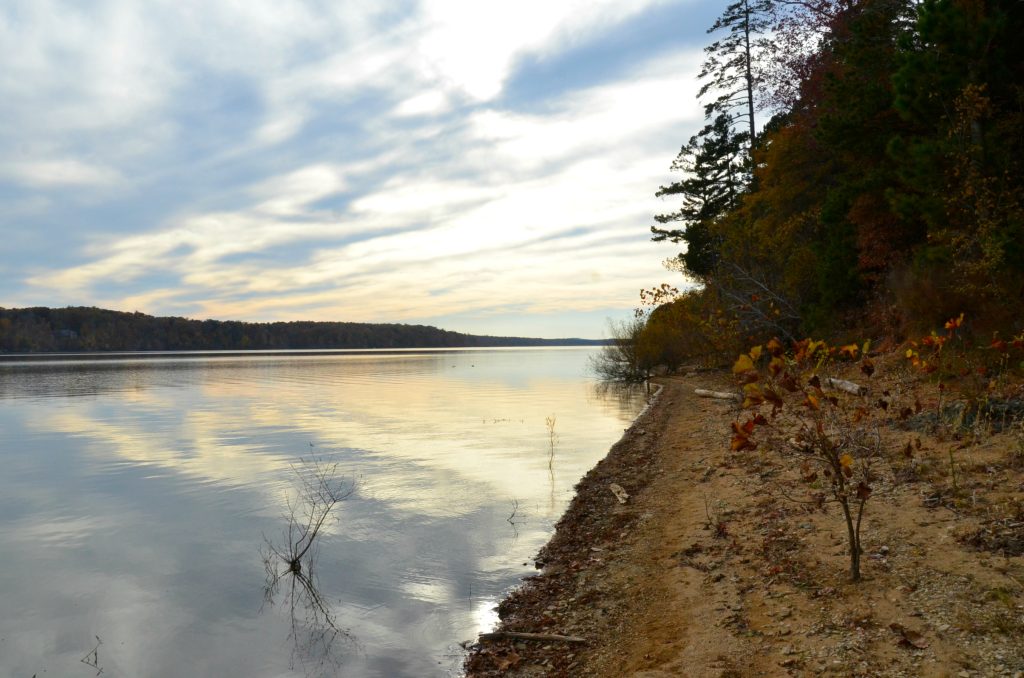
This is the last segment of the river, as at its end, the Dan and Staunton converge to create Bugg’s Island Lake. Gone are views of civilization and farmland, though you may hear traffic on nearby Highway 58, especially early on. The land that flanks the river on both sides is prone to flooding; as a result, there is nothing but forest. Shortly after the Banister meets the Dan, the river begins to widen. Depending on the water levels of Bugg’s Island, the current will likely begin to slow in this area. Roughly two miles downriver is the back side and wetlands of the Falkland property. From here there are several islands, coves, and tributaries (such as Hyco and Aaron’s Creek) that can be explored for fishing opportunities. Afterwards, the river opens up as Staunton River State Park is river left. Upon reaching the boat ramp, one can catch a view of “The Point” an overlook at the State Park where the Dan and Staunton converge.
- Put In: Maple Street Boat Ramp
- Take Out: Staunton River State Park
- Distance: 13 miles
- Estimated Time: 6 – 8 hours
Know before you go: Estimated times and distances are from oldhalifax.com. Virginia law requires wearable lifejackets for all passengers of a boat (both motorized and paddle craft). Life jackets must be readily accessible if not worn. Federal law states children under the age of 13 must always wear a lifejacket while on the water; most rivers in Virginia are considered federal waters. As many stretches of the river are remote with limited cell phone service, be sure to check the weather forecast and prepare accordingly. Additionally, current water levels can be found by clicking here: link.